Why did we do the work
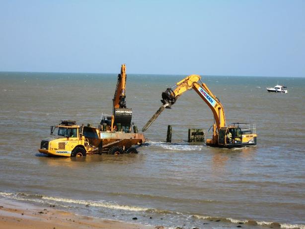
We had lost a substantial amount of the beach between Clacton to Holland on Sea, a facility which is important for local people and for the local economy. This coast protection scheme has provided beaches along the 5 kilometre stretch protecting the cliff and promenade which, together with rock groynes, will combat the effects of coastal erosion. Over 3,000 homes and businesses will be protected over the next 100 years. 23 new beaches in separate bays have been created which can be enjoyed at all states of the tide.
Getting the scheme started
 There was a lot of background work to get this major coast protection scheme off the ground.
The project – the biggest ever for the District, costing up to £36 million and covering 5kms from Clacton Pier to Holland Haven – was signed off by the Environment Agency (EA) on the 10 September 2013.
Consultants Mott MacDonald prepared the Project Appraisal report (PAR) which was submitted to the EA in May 2013.
The scheme will protect more than 3,000 homes and businesses for the next 100 years and is seen as a catalyst for the renaissance of that area.
We got the ball rolling in 2014 by putting up £3million which was matched by Essex County Council (ECC), with a further £1 million being committed by each authority.
Another £512,000 was successfully achieved through the Government’s Growth Fund money and £27.5 million came from Flood Defence Grant in Aid from the Environment Agency.
 Securing the Growth Funding enabled the project to move forward at pace and for us to appoint Mott MacDonald to undertake the preliminary and detailed design early and in advance of the approval of the PAR.
The project team arranged topographical, geotechnical and bathymetric surveys along the scheme frontage to inform the design process and numerical and physical modelling is underway to enable the design to be optimised.
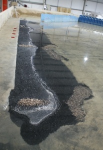 The physical modelling was carried out by HR Wallingford, who are experts at hydraulic research. The establishment tested the design under exacting conditions, recreating what would happen along the coastline in heavy storm conditions.
Planning consent for the scheme was granted on 7 January 2014 for the scheme.
A vital Marine licence was also secured. The Marine Management Organisation (MMO) gave the all-clear for the work to be undertaken following our application. The MMO, which is based in Newcastle, granted the licence which authorises the marine activity to be carried out under the scheme.
VBA Joint Venture Ltd won the contract for the scheme.
We held an exhibition at Clacton Town Hall in Autumn 2013.
What was involved in the work
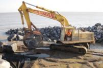
The scheme is made up of 23 fishtail rock groynes and approximately 950,000 cubic metres of sand and shingle beach recharge.
61 vessels delivered 270,000 tonnes of rock from Norway
349 trips were made to the offshore dredge site and 863,000m³ dredged and pumped to the foreshore
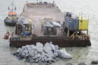
The beach recharge material comprises sand / shingle mix similar to the existing beach material along the frontage. The material was pumped onto shore, via a 800mm diameter pipe line, from a dredging vessel moored offshore during high water periods. The material formed a beach with a crest 18 metres wide and a level of 1 metre below the existing promenade level. Owing to the natural processes that occur on the beach, the shape of the beach will evolve over time.
Because the works were on a beach they were subject to tidal and weather impacts and were undertaken 7 days a week and 24 hours per day.
Phase 1 works between Holland Haven and Fernwood Avenue commenced 22 July 2014 and was completed and the beaches opened to the public on 24 January 2015.
Phase 2 works between Fernwood Avenue and Clacton Pier commenced end of March 2015 and the beaches were completed and fully opened to the public on 25 September 2015.


